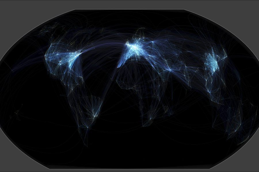
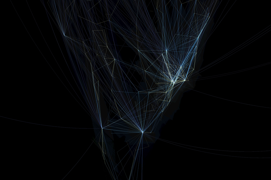


Arup, a global engineering and design firm, has created a visualization of the world’s flight map using open source technology. The silvery, spindly design shows the frequency and concentration of flights juxtaposed on a solid black background.
Michael Markieta, a transport planner in Arup’s Toronto office, has spent the past year developing the flight paths design.
“By identifying patterns and connections, we can start to identify ways to help people to live and work together more effectively,” said Markieta. “Using GIS technology we’ve been able to provide the aviation industry with a very clean and simple way to identify potential opportunities for growth and look at how to adapt to better face the future.”
Markieta used more than 58,000 global flight paths available from open-source project using Arap geographic information systems (GIS) technology. The result is aesthetically stunning but also accessible for any creative mind. Blending technology and real world data, Markieta has indadvertedly captured an artistic rendering of our increasingly globalized world.
For more information visit arup.com